 GeoImgr
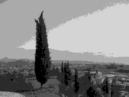
No images uploaded, yet!
How to geotag photos:
1. Upload JPG / HEIC / PNG / WebP images
2. Existing geotags are shown on the map
3. Set the marker or enter the latitude and longitude manually
4. Optionally add additional EXIF tags
5. Hit the button Write EXIF Tags
6. Download the geotagged image
1. Upload JPG / HEIC / PNG / WebP images
2. Existing geotags are shown
3. Set the marker
4. Hit the button Write EXIF Tags
5. Download the geotagged image
Let's keep in touch! Subscribe to our mailing list to receive emails about special offers and discounts, technical issues and announced downtimes, news and product updates.
If you have any questions or experience any issues with this website, please let us know at info@geoimgr.com. We will answer immediately.
FAQ
Geotagging of images refers to the process of adding geographical information, such as latitude, longitude, or other location-related metadata, to an image file. This information is usually stored in the image's EXIF (Exchangeable Image File Format) metadata, which is a standard for storing additional data within image files.
The geographical information embedded in the image helps provide context about where the image was taken or what it represents. This can be beneficial in various ways, such as:
To geo-tag images, users can either capture images with a GPS-enabled device, like a smartphone or a GPS-enabled camera, which automatically embeds the location data in the image, or they can manually add the geo-tags later using software such as our online tool.
When you upload an image to platforms like GBP - Google Business Profile (formerly known as GMB - Google My Business) or publish an image on your website, Google is likely to store the original image, along with its geotags and other metadata (like EXIF/IPTC data), in their databases. However, the images displayed on their platforms undergo optimization for the web; they are reduced in size and stripped of metadata. This is done to enhance the loading speed of the page and for privacy considerations.
It's important to note that despite this stripping process for the public view, Google likely retains access to the original metadata, including geotags. They may use this additional information to rank your profile, images, or websites. The extent to which this metadata influences ranking is a proprietary secret of Google's search algorithm.
Google encourages the enrichment of images with metadata, as detailed on their page on Google Search Central: Image Metadata Best Practices .
JPG is the recommended format for geotagging images because it has a standardized method for storing geotags in the EXIF metadata. This makes it widely compatible with most tools and platforms, ensuring that geotags can be easily read and utilized.
PNG and WebP formats do not have a standardized way of storing geotags in their EXIF metadata. Instead, they store geotags as a non-standardized EXIF extension. As a result, many tools, including the built-in image file property viewers for Windows and macOS, may not be able to read or display geotags from PNG and WebP images.
To easily check for geotags in a PNG, WebP, Heic or JPG image, use an online tool like Geoimgr (tool.geoimgr.com). Upload the image to the tool, and if geotags are present, the longitude and latitude fields will be filled in. A marker on the map will also indicate the geotagged location. This method is quick, convenient, and compatible with various image formats, so there's no need to rely on built-in image file property viewers.
Geotagging is standardized for JPG images, so you can use most tools displaying EXIF metadata, such as the default file property viewers for Windows and macOS, to check for geotags in a JPG file.
However, geotagging for HEIC, PNG and WebP images is not yet standardized, so the default file property viewers for Windows and macOS may not show the stored geotags. To check for geotags in these formats, please use the online tool mentioned above.
Keywords and descriptions can be saved in the EXIF header of image files to provide additional context and improve searchability.
For keywords, they should be separated by commas and include relevant words or tags that a person might enter into a search engine to find the image. Choosing accurate and descriptive keywords can help improve the visibility of your image in search results. The maximum length for the keywords is 6,600 characters.
The description field in the EXIF header should contain a clear and concise description of the image's content, similar to the content used in an HTML alt tag. This description should accurately represent what is visible in the image and provide context for users who cannot see the image, as well as search engines indexing the content. The maximum length for the keywords is 1,300 characters.
By including well-formatted keywords and descriptions in the EXIF metadata of your image files, you can enhance the searchability and accessibility of your images, potentially improving their performance in search results and overall user experience.
We handle subscriptions through Gumroad.com. To cancel yours, just:
- Check Your Email: Find any emails from "Gumroad."
- Click the Link: Look for "Manage Membership," "Subscription Settings," or "Unsubscribe."
- Follow the Steps: Click the link and follow the instructions to cancel.
If you need any help, feel free to reach out to us at info@geoimgr.com!
Uploaded images will be deleted in regular intervals and not used in any other way.